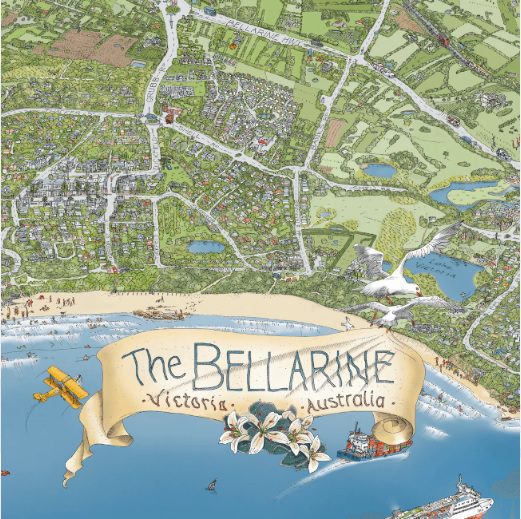
Bellarine Map Posters
Description THE BELLARINE MAP – available in four sizes (unframed) This joyful hand-drawn map of The Bellarine has it all – documenting the beautiful coastal vistas and everything in-between. Locals and visitors will cherish the capture of their favourite wineries, golf clubs, attractions, cafes, beaches, bike tracks, railways, ships, sailboats and ferries, water activities, wildlife, landscape and more. Produced, hand-drawn, coloured and printed locally! Areas covered include Queenscliff, Point Lonsdale, Ocean Grove, Barwon Heads, Marcus Hill, Wallington, Swan Bay, Mannerim, St. Leonards, Indented Head, Portarlington, Drysdale, Clifton Springs, Curlewis, Leopold, Moolap, a touch of Geelong, past the You Yangs and up to Melbourne – oh and a sneak peek of Sorrento and that other peninsula! The Bellarine Peninsula is on Wadawurrung Country. Each print comes with a Grid Reference & “Can You Find?” list.